| CARVED IN STONE.us |
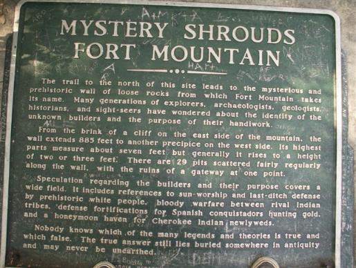
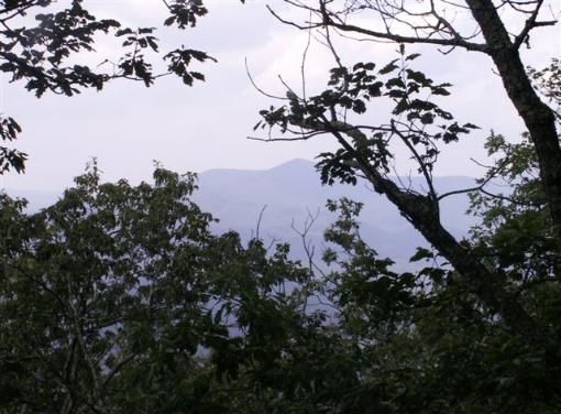
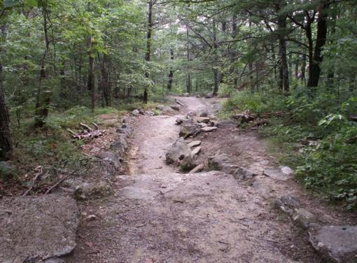
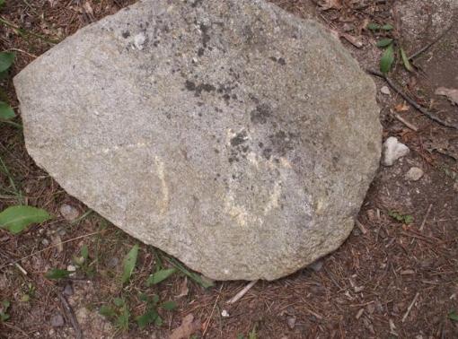
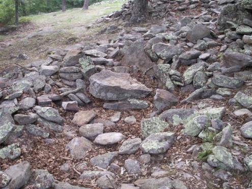
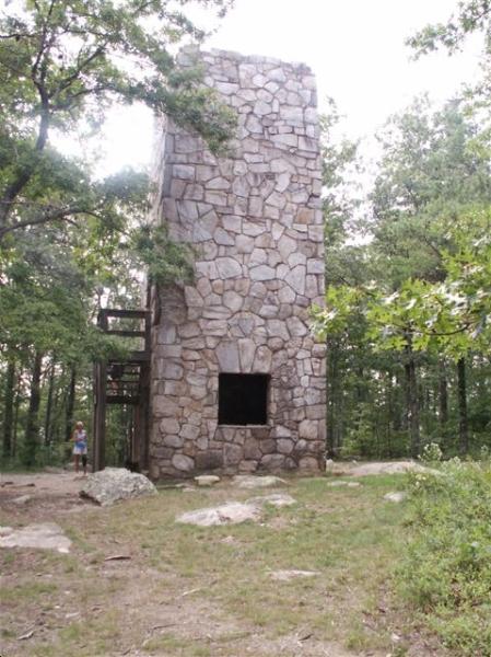
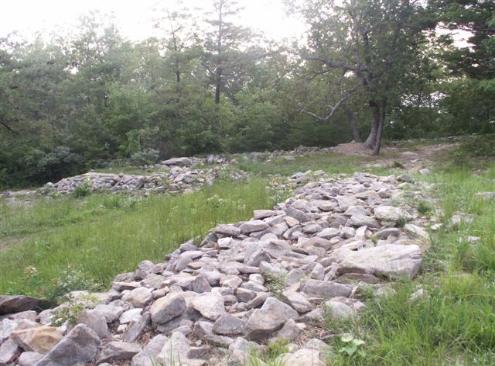
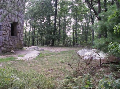
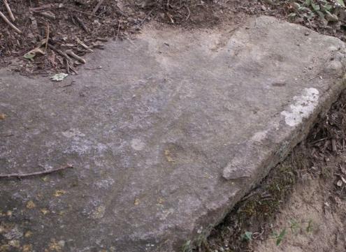
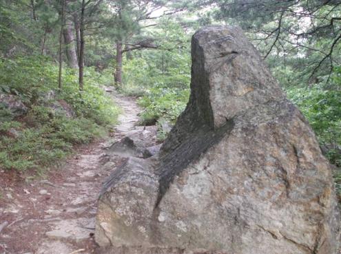
The Enigma of Fort Mountain Interpreted by Tom Cox With illustrations and Photos ====================================== Located in the Northwest Georgia Mountains above Chatsworth, the Cohutta Range rises suddenly above the glacial scar from the last ice age. The terrain changes from 700 feet above sea level to more than 3000 feet. These mountains were pushed up by the South- progressing glacial ice of more than 10,000 years ago. Photo: Historic marker located at the beginning of the Promenade in the parking lot. At its highest point, with the most severe cliff overlooking the glacial valley below, and facing the Western sunset, there exists a large ring of rocks marking the boundary of an enigmatic rock-walled structure atop Fort Mountain. This site has been a mystery and the object of much speculation as to its age and purpose for more than 200 years. However, I believe the evidence is clear that Fort Mountain was built more than three thousand years ago by visitors from the Mediterranean & Iberia (now, Spain). The site is located at the highest point of the Cohutta Mountain Range, near the Southern end of the Appalachians. The cliff side drops nearly vertical for more than 2000 feet to the Murray County, Georgia terrain. One can see Alabama and Tennessee from there. Photo: Looking North from Fort Mountain towards the Cohutta Mountain Range We arrived at the paved road’s end within Fort Mountain State Park in late afternoon June 20th, near the summer solstice event. We try to visit high places new to us, on, or near the solstices. It makes it much easier for us to locate evidence that the site includes sun and celestial markings. The half mile walk to the fort followed a slightly sloped path upward and was marked by rocks and stones on either side, making a promenade. Having an approach promenade was practiced by nearly all European and Mediterranean cultures when building “High” worship sites and fortresses. The path is worn down over centuries of visitors. The rocks lining the promenade and used in the building, were not all from the mountain. It is possible that bringing a stone to the site was a type of offering made by pilgrims. Photo: The Promenade path to the “temple” (Fort Mountain) worn by centuries of pilgrims followed later by modern visitors. Some later manmade concrete was added. I found stones with carvings on them. The photo shown reads “Sun” or “Baal” in Celt- Iberian characters (G-L). Carving the “holy word” for “Baal” may have been an effort of worship and may have been delivered to the site as an offering. Photo: Carved, worship offering stone with “G-L,” the word for “Baal” On the inside of the walls of the “Fort” are depressions beginning 6-8 feet long ending at the base of, or inside, the rock wall. One local explanation was that this was a “Cherokee honeymoon” site where newly married Indian couples would come to celebrate their nuptials in one of the “love nests.” Another legend spoken of by the Cherokee Indians, before they were forcibly removed from their lands in Georgia in 1838, was that the Fort was occupied by a “Moon-eyed, light- skinned and red headed” people whose origin was not known to the Indians and who were already living there before the Cherokee arrived hundreds of years before. One explanation within plausible reality is the evidence of similar structures in Alabama, Georgia (Atop Stone Mountain near Atlanta) and Tennessee built by the Welsh Explorer Prince Medoc in the late 1100’s. There is still evidence of fortresses built and occupied by his party in all three states and ancient diaries detailing several voyages to this area. It has now become obvious that Christopher Columbus was a “late comer,” with many other discoveries showing signs of much earlier expl0ration from earlier sea going explorers. Upon first arriving at the site, we noticed much of the wall had been pulled down and was strewn outward. It appeared that the stones, weighing up to 200 pounds, had been built originally to a height of approximately six–to-seven feet. There is an observation tower built by the WPA, in the 1930’s, with rocks taken from the fort wall. The tower was recently restored. Photo: A section of the main wall with the dwelling collapsed. Should we be able to archaeologically excavate several of these, we would certainly find evidence of life at the fort and who built it. The tower is located at the highest point of the fort. This is unfortunate because the removal of rock from the walls and its location at the high point destroyed some valuable artifacts and evidence, the most important of which, lies just to the side of the tower. Photo: The tower was built in the 1930’s using rock from the temple and the walls. It has been recently restored When we observe that modern white men have frequented ancient Southern sites, we see that much has been lost due to the “treasure is buried under every rock” mentality of those who took this land from the Cherokee. This was the case at Fort Mountain, where it was obvious that reckless excavation had taken place with no concern for protecting the historical significance of the site. My conclusion is that Fort Mountain was a Baal Temple worship “High Place” and simultaneously, a military garrison and was located here as protection for those who came to the area to colonize, mine gold and copper, trap fur and trade with other occupants. Without more sophisticated means and using other sites with which to compare, I put its active time at approximately 500-1000 BC. The trenches, butted up to the walls, were living quarters, which were originally dug out, then covered over by timbers, then rocks and soil and plants. There are many examples of this in the South and Eastern United States. If the reader has knowledge of how ancient cities were constructed, you may remember that the walls around cities had dwellings built up against the inside walls, as was the case when Jerusalem was rebuilding in approximately 450 BC. Nehemiah, the Prophet and Governor, in order to speed up construction of the protective Jerusalem outer wall, then instructed families to build their dwellings against the wall and be responsible for that section of the wall. It is interesting to note that Fort Mountain may have been built approximately the same time in history with similar a structural strategy. Photo: A section of the outer wall looking toward the promenade gate. These walls would have been stacked six to seven feet high. Dwellings were built against the wall and faced inward Near the top and a few feet from the tower, (as discussed above) we discovered a trench lined with large rectangular stones and approximately twenty feet long and ten feet wide, with an opening on the end facing westward. The trench was filled in during the WPA construction. We observed that the opening of the trench was lined up with the setting sun on the longest day of the year. This is most likely a Baal temple/solstice site, like others we have found in the South. Baal worship is the worship of the sun. Baal worshippers primarily came from the Mediterranean and Southern Europe. The objective of the temple facing the summer solstice is to set a mark to measure and predict the seasons and the celebration of the sun’s positions: the summer and winter solstices and the fall and spring equinoxes, all important to visitors to the Americas 3000 years ago. Above: Behind the tower are the ruins of the Baal-Sun Temple marked by the two large stones facing toward the setting sun on, or about June 21. These stones were covered with timber, rocks and sod. Light coming in at Sunset on the longest day of the year allowed observers to mark all seasons and events important to the ancients Walking an imaginary line from the front of the Temple toward the setting sun, I walked to the edge of the drop off. Near the edge, carved into the rock was an arrow pointing directly toward the sun and the word “summer” in the old Lybian language. Above: Stone slab found on the edge of the precipice facing 277 degrees. The Arrow (pointing toward the right in the photo,) points west and toward the Lybian word (looks like “100”)for “summer”, indicating the solstice. Walking the inside circumference, we discovered what may have been be a “birthing chair.” Giving birth at higher altitudes, where the atmospheric pressure is often less, was a ancient way to ease the giving of birth. Birthing tables similar to this one can be found in ancient Europe and associated with the Mediterranean cultures. This presents more positive evidence that visitors from those cultures built the Fort Mountain Site. Photo: The “Birthing chair” Having a child at high altitudes made the birth quicker Being in this place, imagining those early builders who came from so far away, so long ago is fascinating to imagine: the knowledge they had of the heavens; the effort they put forth to build the site; and then, to wonder what happened to them all? Did they fade into the Native American population? The enigma still exists. The mystery still not completely solved, but the fascination with the possibilities still lingers and excites. There is much more to discovery at Fort Mountain. ============================== Copyright © 2015 Thomas D. Cox, Sr. All Rights Reserved. No information, illustrations, photographs or any other part of this paper may be reproduced in any form without the expressed, written permission of the author. |